Northern Plains Enhanced Risk
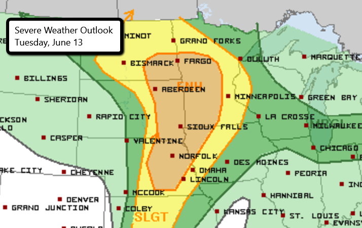
There is an Enhanced Risk of severe weather today for parts of the northern and central Plains. This includes Sioux City, IA, Sioux Falls, SD, Fargo, ND, St. Cloud, MN and Grand Island, NE.
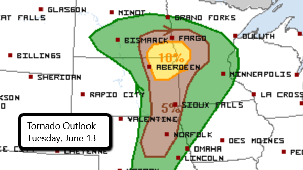
Thunderstorms are expected to begin developing later this afternoon and continue into the evening and overnight. There is a risk for isolated tornadoes as storms initially develop. Large hail is also possible. The main threat will transition to wind damage and storms merge into a line and race across Minnesota and Iowa.
This event looks to continue into the overnight hours when most people will be sleeping. It’s very important that you have multiple ways to receive severe weather alerts no matter the time of day!
Follow us on Twitter for the latest!
Watch chaser live streams here.
What People Are Saying...
Twitter Mentions
Reddit
Jetpack Comments