High Plains and Upper Midwest Severe Storms
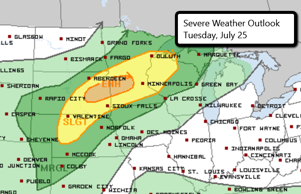
There is an Enhanced Risk for severe weather late this afternoon and tonight in parts of eastern South Dakota and western Minnesota. This includes Watertown and Brookings, SD and Willmar, Hutchinson, and Marshall, MN.
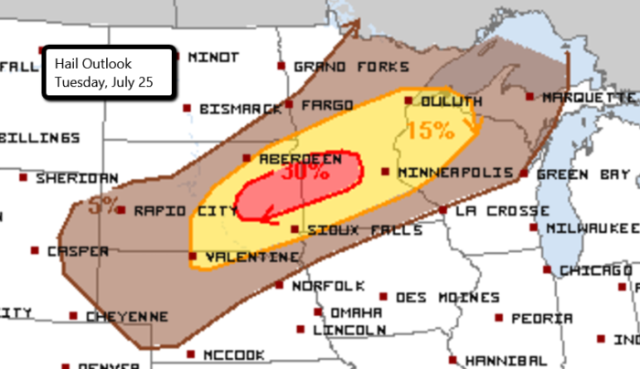
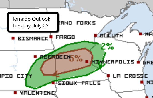
The greatest threat with initial storm development will be the potential for very large hail, isolated tornadoes, and damaging wind gusts. As these storms progress eastward, damaging wind gusts, hail, and a few tornadoes will continue to be a concern.
Follow us on Twitter for updates.
Watch live streams here!
What People Are Saying...
Twitter Mentions
Reddit
Jetpack Comments