Unprecedented Midwest Severe Threat

A very strong storm system is bringing an unprecedented threat for severe weather to parts of Minnesota, Iowa, and Wisconsin this afternoon and evening.
A very rare December MODERATE risk is in place from west central Iowa into southeastern Minnesota and far western Wisconsin. This includes Rochester, MN, Ames and Waterloo, IA, and La Crosse, WI. The surrounding Enhanced risk area stretches into Omaha and Lincoln, NE, Des Moines and Sioux City, IA, and the southern Twin Cities, MN metro area.
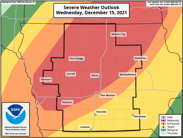
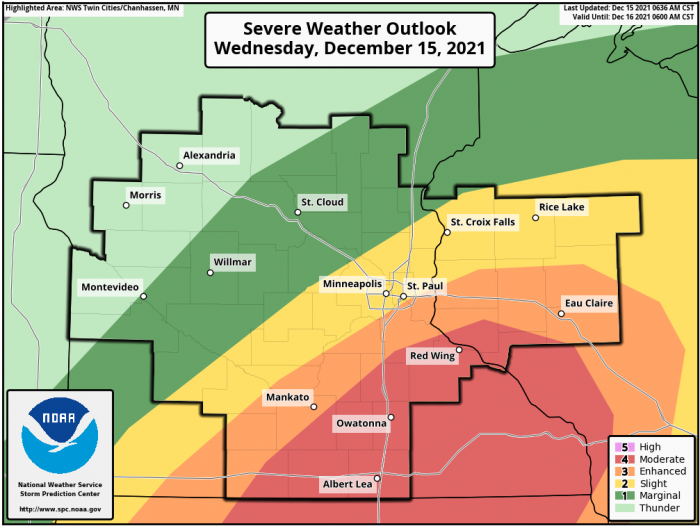

The SPC states, “Widespread severe wind gusts of 60-75 mph along with at least a few tornadoes are likely from late afternoon through this evening across the Mid-Missouri Valley to the Upper Mississippi Valley. Embedded gusts of 80-100 mph and a nocturnal strong tornado or two are also possible, particularly across western to northern Iowa and southeast Minnesota.”
Some areas under the Moderate risk have snow on the ground! Storms are expected to develop quickly and race across the area after dark. Preparations need to be made NOW because warning time may be limited due to the expected speed of this line of thunderstorms.
After the severe weather threat diminishes, winds in these areas are expected to stay very strong. Gusts could top 60 mph overnight in some spots. Downed trees and power lines are possible. Travel will be very difficult for high profile vehicles.
What People Are Saying...
Twitter Mentions
Reddit
Jetpack Comments
Comments are closed here.