Idalia Upgraded to Hurricane Status: Expected to Landfall as Major Storm
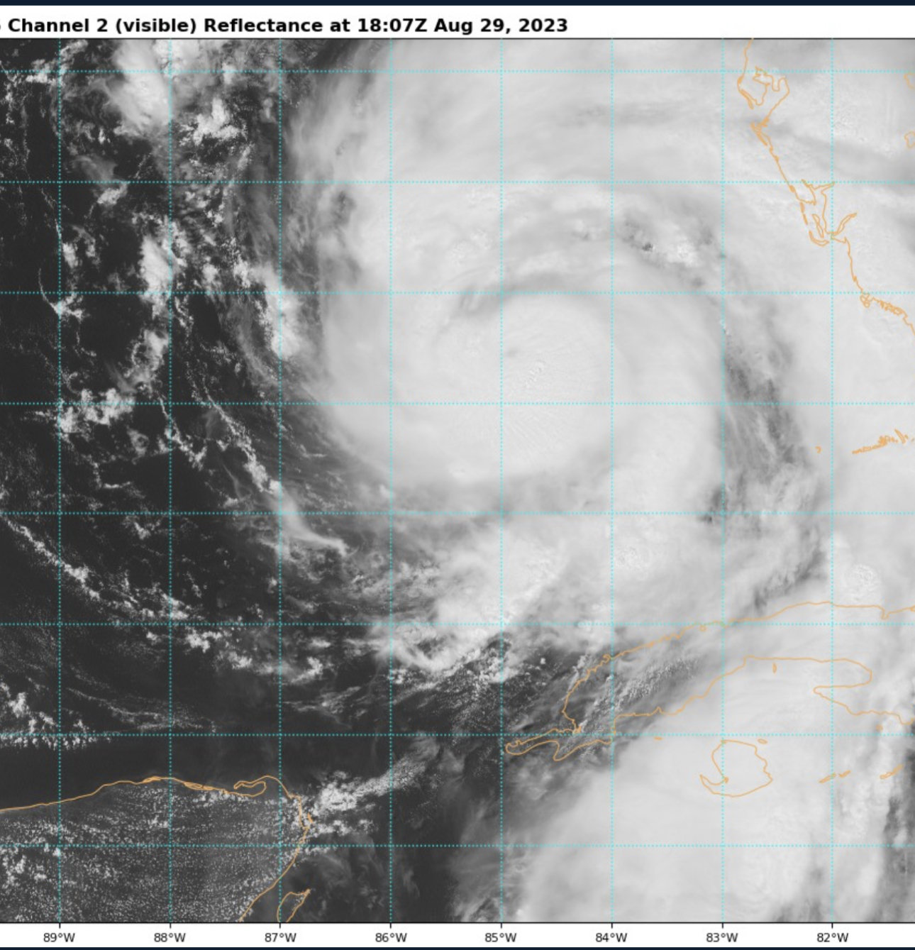
The National Hurricane Center (NHC) has upgraded Idalia to a hurricane overnight. Hurricane Idalia, now a Category 1, is predicted to make landfall as a major hurricane on Wednesday morning in NW Florida. Hurricane Hunter data, along with radar, is indicating Idalia now has a closed eye. The path that Idalia is forecasted to take contains deep surface temperatures of 86-88 degrees, which may cause it to rapidly intensify as it moves further into the gulf towards Florida.
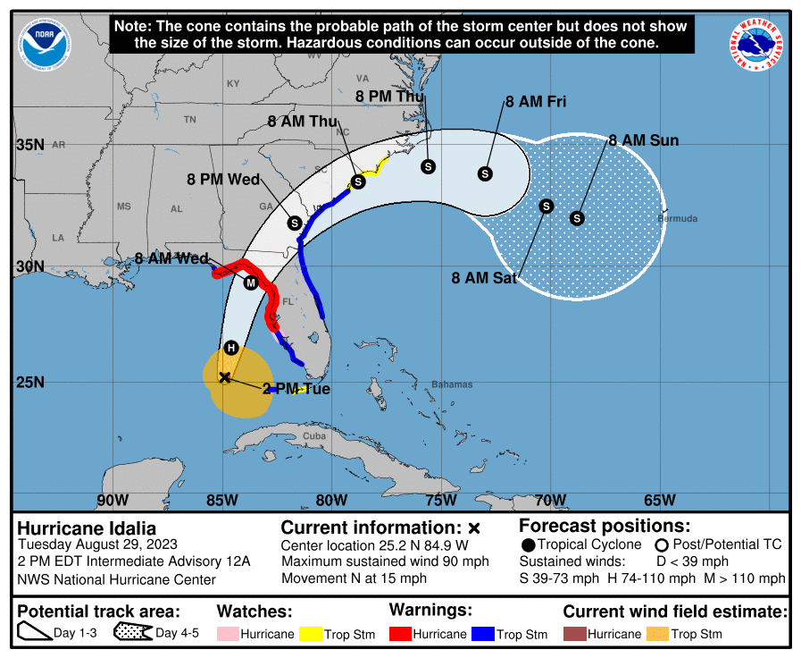
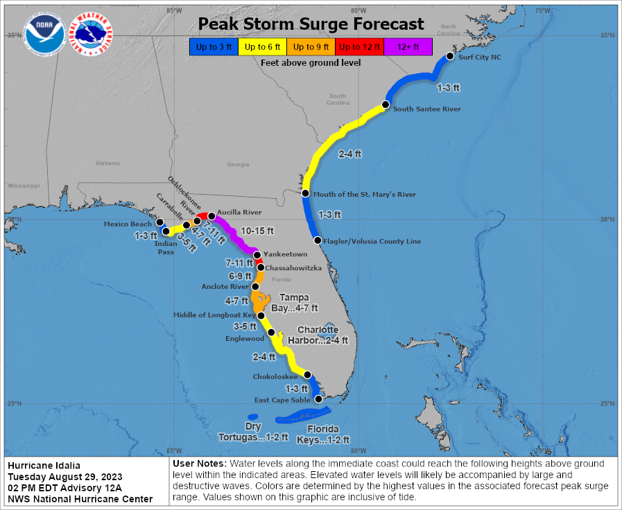
Much of the northwestern coast of Florida is now under a hurricane warning. The current NHC forecast is predicting Idalia to peak at Category 3 with 126 mph winds. The highest storm surge is expected to occur in the Big Bend region of the state. In this area, the NHC has increased the surge prediction to a catastrophic 10-15 feet. Conditions along the coast will be severe and life threatening.
Many areas along the coast now have mandatory evacuation orders. Vulnerable coastal cities, such as the island city of Cedar Key, are asking residents to evacuate today before the extreme storm surge moves in. According to emergency management officials, residents need to leave the island by 4pm today because the bridges will not be able to hold up to the surge. NHC advisory now states that it will be “an extremely dangerous major hurricane before landfall…”.
The exact landfall location of the eye is still unknown, however they are still expecting hurricane conditions along a significant portion of the western coast. Many cities are now distributing free sandbags to residents to prepare. At these sites, there is a constant stream of locals arriving to fill their own sandbags. These locations will be closing this evening ahead of the first bands of Idalia.

Idalia will be the first hurricane to make landfall on the continental U.S. in 2023.
What People Are Saying...
Twitter Mentions
Reddit
Jetpack Comments