Michael to Make Landfall Today
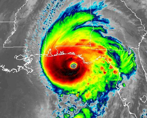
Potentially catastrophic, category 4 Hurricane Michael is posed to make landfall later today along the Florida panhandle near Panama City. As of 10 AM ET, Michael had maximum sustained winds of 145 mph.
Storm surge is a major concern with Michael. The worst surge of 9-13 feet is expected between Tyndall Air Force Base and Keaton Beach, FL. A National Ocean Service water level station at Apalachicola recently reported over 4 feet of inundation above ground level.
Widespread wind damage and power outages are also expected. Heavy rainfall is likely as is localized flash flooding. Even if you live miles from the coast, you will not be immune from flooding.
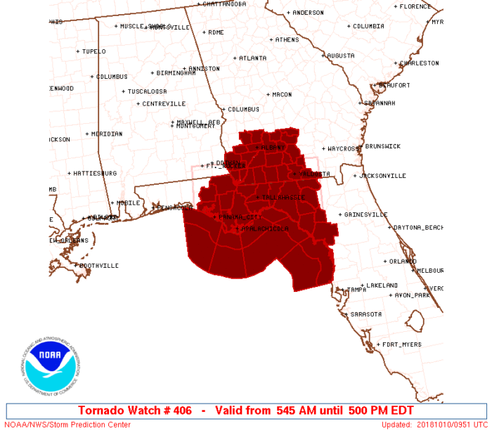
Tornadoes will also be possible today as Michael nears landfall. A Tornado Watch is in effect for parts of Florida and Georgia until 5 PM.
This will be the strongest hurricane on record to make landfall on the Florida panhandle. It will also be the strongest hurricane on record to make a U.S. landfall in October.
SevereStudios has multiple live streams in and around Panama City, FL to capture Hurricane Michael’s landfall.
Multiple Hurricane #Michael live streams NOW at https://t.co/ha9YvhqMm4 pic.twitter.com/GJ0EBDxYJs
— SevereStudios (@severestudios) October 10, 2018
Follow us on Twitter for updates as Michael nears landfall.
What People Are Saying...
Twitter Mentions
Reddit
Jetpack Comments
Comments are closed here.