Major Storm System this Weekend

A major storm system will impact the central U.S. this weekend. Double digit snowfall and severe weather will be possible.
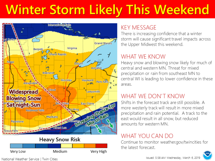
Right now, the heaviest snow looks to fall across parts of south central Minnesota. The National Weather Service in the Twin Cities warns of “large scale double digit snow totals.” Blowing snow and white-out conditions will also be possible in parts of the Dakotas and western Minnesota.
Farther south in the warm sector of this system, severe weather will be possible. The Storm Prediction Center is highlighting a 15% risk of severe storms from central Missouri to the Gulf Coast and from east Texas to north central Georgia.
Severe Weather Threat Saturday, March 9
Damaging wind gusts look to be the primary threat. The risk for an isolated tornado cannot be ruled out. Storms look to develop as early as Saturday afternoon and could continue into Sunday morning.
This will be a high impact winter weather event across the Upper Midwest, but details will change as we get closer to the weekend. Stay tuned!
What People Are Saying...
Twitter Mentions
Reddit
Jetpack Comments